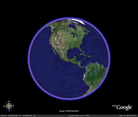
Workshops/Creating Engaging Learning Activities Using Google Earth
Session Information
- Level - Introductory, no previous experience with Google Earth required
- Audience - Instructors interested in using Google Earth in their courses
- Time - 50 minutes
Before the Session
This session is hands-on, so please bring your laptop if possible. If you cannot bring a laptop, one will be provided for you.
General Description
Google Earth is a wonderful example of how a tremendous amount of information can be assembled on the Web into a familiar and highly usable interface that promotes learning. Anyone who has used Google Earth understands how the application draws you in and encourages exploration. Recent versions of Google Earth have added some amazing interactive features, including the ability to turn back time and view the world as it was captured in years past. New galleries of information can be added to the map, including 3D models of ancient Roman architecture. Google Earth can also be used to create tours that can be used in courses to engage students. Google Earth images and tours can be embedded in Course1 and D2L pages, integrating them with other course material and making student access to them seamless. Students can use Google Earth in the same way to support class projects. Many disciplines can benefit from Google Earth content and activities and this workshop will cover examples from English, History, Biology, and other areas.
Learning Outcomes
Following this session, you will be able to...
- Install the latest version of Google Earth
- Use the navigation controls to move around the globe
- Use the search panel to navigate to specific locations and save them to your "My Places" list
- Describe how Google Earth uses the term "layers" when referring to map content
- Customize your map by toggling layers on/off
- Add placemarks, polygons, paths, and images to your map
- Record and save a tour
- Use historical imagery
- Measure distances using the Ruler
- Share static images and live Google Earth content via email and D2L
- Describe how KLM files function and demonstrate them using the Earth Gallery
- Describe at least one way that Google Earth could be used in at least one of your courses
